Reliable Geospatial
Intelligence lead
the Decision
Connecting with the Geospatial
Data over Japan.
- +81-3-6362-5000
- Hours:Weekdays 9:00-17:00
Reliable Geospatial
Intelligence
-

- Airborne LiDAR
- High Density Point Cloud Collected by
Aircrafts & UAVs.
-

- Aerial Imagery
- Comprehensive Archived Data Up to
5 cm Resolution.
-

- Mobile Mapping System
- Various Sensors Utilized in a Wide
Range of Purposes.
Stories
-
High density 3D topographic data contributes for flood risk mapping.
-
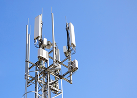
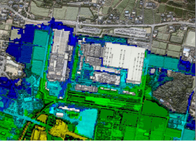
Extraction of 5G base station installation candidates using DSM ortho photo data.
-
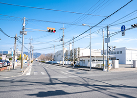
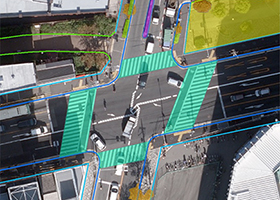
High precision map creation for managing accessories around the road.
-
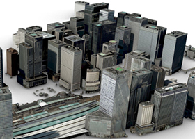
Creating precise 3D building model from the imagery to analyse city space.
-
Feature extraction from the imagery is performed by AI processing.
We provide the sources that
contribute your discovery
-
Looking for a partner in Japan & Asia?
Not only in Japan but also we are selected as the best partner of geospatial market in the Asia.
-
Timely and Comprehensive Demand?
Our comprehensive archive imagery data enable us the rapid delivery, leading to accelerate your business.
-
Discovering the best practice?
We support your project based on 6,000+ project experi-ence.
- +81-3-6362-5000
- Hours:Weekdays 9:00-17:00
Services
Aerial Survey
The origin of our business, past and present high
quality data backed by 70+ years of experience.
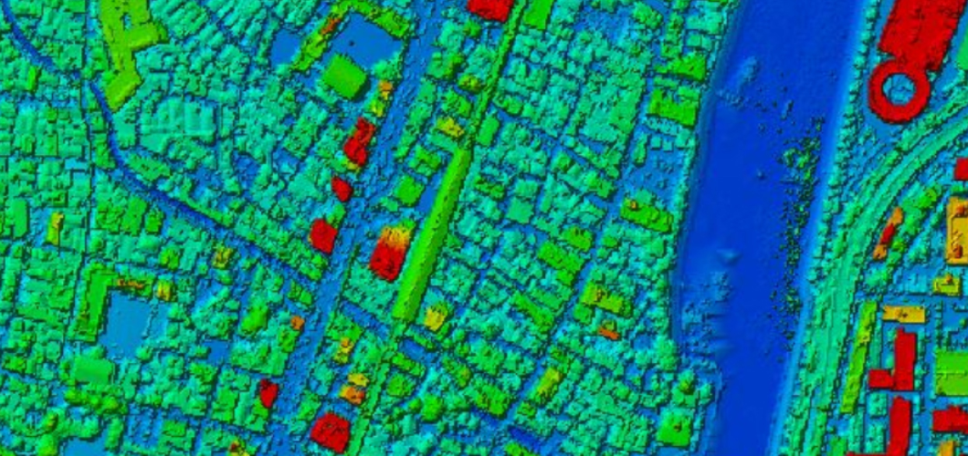
Airborne LiDAR
Creating DTM or DSM flexibly from high density point cloud to your work site with new data collection or archived data.
Archived data
- Minimum sales unit: 1 sqkm
- 2 meter interval point cloud
- Vertical accuracy±15cm, Horizontal accuracy±30cm
- Data format:LAS, TEXT, SHAPE, DXF
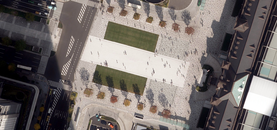
Aerial Images
Bringing new data collection on demand and historical data from 5cm resolution.
Archived data
- Minimum sales unit: 1 sqkm
- Data format: TIF/GeoTIF
- This product may not be sold depending on the purpose of use of the customer.
- To use this product, please comply with “License Agreement for the Use of Image Data“.
Mobile Mapping System
Utilized in a wide range of purposes with
the latest measurement equipments.
Multiple purpose can be discovered from the
collected 360 degrees data with
1/500 accuracy.
Fusion of 3D laser scanning point cloud and images.
Connecting with the Geospatial Data over Japan.
- +81-3-6362-5000
- Hours:Weekdays 9:00-17:00